Tropical Central / Cyclone Warning Center

We are working on this site and will be back online soon.... Jason Scott

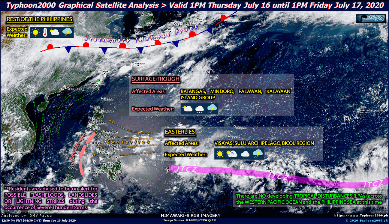
Current Graphical Satellite Analysis From Typhoon2000.com:

Interactive Typhoon Discussion (JTWC) 

Current Information From The Joint Typhoon Warning Center:


Latest Tropical Weather Outlook:

Current North Atlantic Graphical Analysis:

Interactive North Atlantic Hurricane Discussion 

Latest Tropical Weather Outlook:


Latest Tropical Weather Discussion:


Current Eastern Pacific Graphical Analysis:

Interactive Eastern Pacific Hurricane Discussion 


             Breaking News From Our Partner @ NASA'S Hurricane Web Page

                                                    Cyclone Warning Center Blog 

WEEKEND WESTERN PACIFIC TROPICAL REPORT FOR June 9, 2012

June 9, 2012

AFTER A SHORT RESPITE, 90W STEPS UP AS THE “NEXT BIG THING”…OR IS IT?

Welcome weekend tropical weather hunters! After a rather busy end to May, and start to June, things have quieted down just a bit across the tropical WESPAC, just as I had forecasted it would. Things are starting to heat up a little bit our east along the ITCZ with the declaration of 90W INVEST Friday morning, 08 June. A lot of theories abound with a storm that starts this far out in the ocean, and realistically speaking, there is much to be concerned with. But, it would appear that 90W might just be a big baby.

90W INVEST

On Friday morning, at approximately 0500PST, the JTWC and NRL both declared an area of disturbed weather as 90W INVEST as it churned its way to the west. The system started off looking quite impressive, with a healthy outflow, and clear slow circulation in the clouds, with some evident banding starting to appear. This was evident enough for the JTWC to re-issue an advisory Friday afternoon, upgrading the 24-hour formation potential to MEDIUM. By Friday evening, June 08, things were already starting to look a bit shaky for this system to most of us, with some evident degradation of the LLCC and banding, as well as a decrease in overall cloud cover and thunderstorm development. However, I surmised the storm was starting to contract, as they do in the early stages of TD and TS development. Sure enough, by wake up time this morning, the JTWC had issued a TCFA (Tropical Cyclone Formation Alert) at 2030UTC (0430PST) and upgraded the 24-hour formation potential to HIGH Technically speaking that is where things stand now, but the syste looks to be in  trouble. More on that after I share with you the latest information on 90W INVEST…

Source:                                                                                  NRL                                                JTWC

Time/Date:                                                               0900UTC/1700PST                          0600UTC/1600PST

Position:                                                                        5.2N, 155.7E                                     4.6N, 152.9E

Direction:                                                                      W@ 10-15 kts                    SSW@ 10-15 kts (likely relocation)

Winds:                                                                            20-25 knots                                       15-20 knots

Pressure:                                                                           1007 mb                                            1006 mb


Photo courtesy of NRL/JTWC

90W INVEST- 4.6N, 152.9E, 15-20kts, 1006mb

90W INVEST is forecast to have a very tough time getting organized due to some unfavorable atmospheric conditions in its path. The LLCC is currently poorly-defined and elongated. Computer forecast models are a bit split on this one now. Most were showing development and movement NW towards Japan. Now, NOGAPS shows no development of 90W, and has it moving west as a rather disorganized area of showers and thunderstorms. GFS, on the other hand, maintains its grip on this storm’s development and movement to the NW, but the forecast track has shifted about 300km to the west. However, things do change in the WESPAC, and this system is very far out to sea, so there is a lot of time for things to develop, and for us to watch it.

AROUND THE NEIGHBORHOOD…

Elsewhere in the tropical WESPAC, the ITCZ is a bit quiet inside of 155E longitude. A high pressure area located just east of the Philippines is currently keeping things clear and dry over the WESPAC from Guam to the South China Sea. The remnants of 99W are lingering about near 19N, 157E after being dragged up by the surface trough associated with MAWAR as it made its ETT and sped off to the NE. A TUTT cell is located near 17N, 153E. The southwest monsoon has been pushed to the west by this high pressure area, and will not be able to start progressing eastward until the high breaks down in a day or two. The Mei-Yu baroclinic zone continues to migrate slowly northward and its effects are being felt much less in tropical areas as we head into the idle of June.

CRYSTAL BALL…

The immediate future looks rather quiet as we continue to monitor 90W INVEST. Computer forecast models are showing an increase in activity as we go through next week, and even the NOGAPS has predicted some tropical development east of the Philippines. Since things are quiet, the SST’s will warm back up along the ITCZ and activity should also start to increase as we get around to next weekend. The Mei-Yu baroclinic zone activity should be almost non-existent for areas of the tropical WESPAC. One point of note is that the SST’s in the EASTERN Pacific have been reading higher than normal, which means the ENSO may be entering an El Nino phase in the near future.

Thanks for viewing! As always comments and suggestions aare welcome!

We will keep you posted here at CycloneWarningCenter.com 

Have a happy storm-hunting weekend!


The Tropics become Active towards the Second Half of June in The Gulf Of Mexico

June 9, 2012


 The Atlantic is currently quiet, with the only feature of interest being an old frontal boundary over the northern Gulf of Mexico that poses no significant threat for tropical development over the next few days, though it will bring rainfall to the gulf coast. As discussed back when Beryl was making landfall in Florida, the first half of June here is quiet, and will continue to be so through at least the 15th.

However, the signs for the next round of tropical activity have already been showin...


Continue reading...
 

Tropical Storm Chris May Form in the Gulf of Mexico by Next Weekend June 16

June 9, 2012

 A good majority of the forecast guidance is now pointing towards tropical development to occur in the far northwestern Caribbean sometime next weekend and for this tropical system to track northward across the Gulf of Mexico shortly thereafter. With such strong model agreement and consistency, my confidence is growing that we will have the development of Tropical Storm Chris by sometime next weekend.

Looking over each individual model member: The GFS model continues to be consistent in that l...

Continue reading...
 

Will predicted MJO pulse bring chance for first development of the season?

June 8, 2012


Even though we had tropical storms Alberto and Beryl already, they were both outside of the hurricane season. Since then, things have been nice and quiet. There are, however, indications that this may change. Let’s take a look at why.

There is an atmospheric phenomenon called the MJO or Madden-Jullian Oscillation that can sometimes lead to increased tropical cyclone formation when it is in its favorable mode. Think of it as a period of fertility in the tropics. A time when rising motion in ...


Continue reading...
 

2012 Hurricane Season Forecasts

June 8, 2012

Although we've already had two tropical storms, today marks the "official" beginning of hurricane season.

Meteorologists agree: strong upper-atmospheric wind shear caused by a developing El Nino and cooler water temperatures in the Atlantic Ocean should prevent some smaller tropical waves from fully developing into hurricanes.

Watch the Gulf of Mexico

While water temperatures in the central and eastern Atlantic are currently cooler than normal, the water in the Gulf of Mexico is still very warm....


Continue reading...
 

Tornado Threat Denver, Cheyenne Thursday Evening

June 8, 2012

Tornado Threat Denver, Cheyenne Thursday Evening

Twitter user @BarrettTyron took this photo Wednesday evening in Colorado showing mammatus clouds, often seen near a tornado-producing thunderstorm.

UPDATE:

As of 8:00 p.m. EDT, reports of earlier, unconfirmed tornadoes had been reported 7 miles south of Wheatland, Wyoming and in Laramie County, Wyoming accompanied by up to 1.25" h...


Continue reading...
 

NASA Sees Tropical Depression Kuena Weakening from Wind Share

June 8, 2012
Hurricane Season 2012: Tropical Storm Kuena (Southern Indian Ocean)
06.07.12
 
MODIS capture this image of Tropical Storm Kuena in the Indian Ocean on June 6, 2012 at 06:20 UTC (2:20 a.m. EDT/U.S.)› View larger image
This image of Tropical Storm Kuena in the Indian Ocean was captured by the MODIS instrument on NASA's Terra satellite on June 6, 2012 at 06:20 UTC (2:20 a.m. EDT/U.S.) before it weakened to a tropical depression.
Credit: NASA/Goddard MODIS Rapid Response Team
AIRS revealed that the area of strong thunderstorms (purple) and coldest cloud top temperatures had grown smaller since June 6› View larger image
NASA's Aqua satellite also passed over Tropical Depression Kuena and the AIRS instrument onboard provided an infrared loo...

Continue reading...
 

Make a Free Website with Yola.